I struggled to find a decent map showing the various neighborhoods of Lowell. The obvious conclusion: I should make my own.
It turns out that Google Maps knows about them, so you can search for, say, The Acre, Lowell, MA and get a map showing the boundaries. Here’s what you get when you combine all of them hastily in Photoshop, draw thicker borders, and add too-large labels:
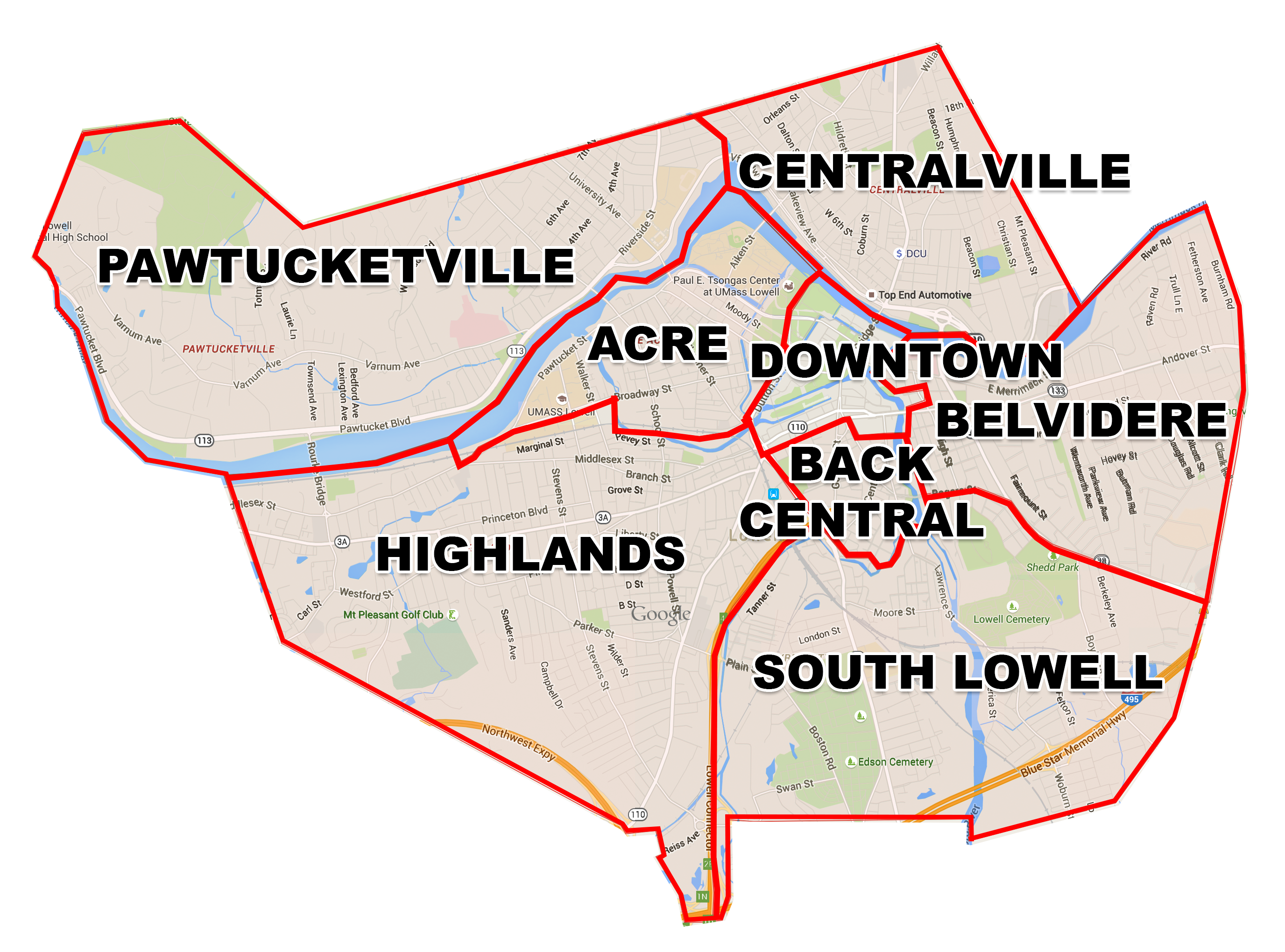
(Click for a larger, 3MB version)
The old city site has some information which is now hard to find, but it included this small map that turns up a few places… It’s what spurred me to create something else.
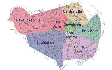
(The canonical source is this archive.org version of the City’s site.)
There’s also this PDF, whose canonical source is on the testwww.lowellma.gov site which doesn’t sound like it’s meant to stick around, hence me saving a copy.
What’s interesting about that PDF is that it defines some additional neighborhoods—the Highlands also have the easternmost section split off into Lower Highlands, Belvidere has its northwestern portion as Lower Belvidere, and the section of South Lowell that’s west of the Concord River is known as Sacred Heart. Those neighborhoods don’t seem to be widely referenced anymore.