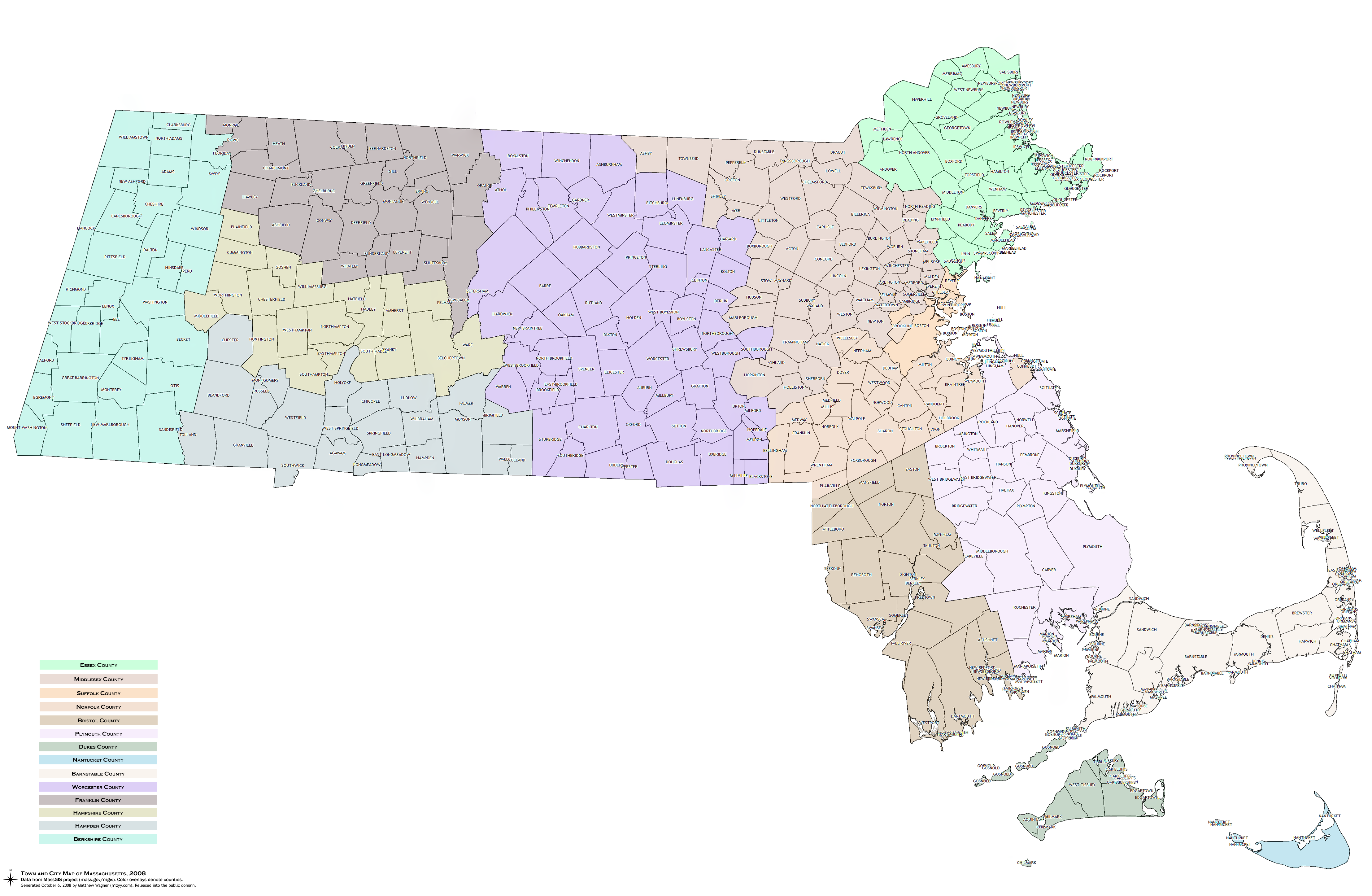
I was pretty annoyed that it seemed impossible to find a map that showed all the towns and cities in Massachusetts. Google Maps or the like don’t cut it for what I was looking for: just the town ‘political boundaries.’ It turns out that Massachusetts has a sizeable GIS repository, appropriately named MassGIS. So I grabbed a couple map sets and used QGIS to make my own map. It doesn’t provide an “Export as PNG” option, so I panned around, saving them as images, and then used Windows Live Photo Gallery to assemble them as a ‘panorama.’ (I was going to use Photoshop, but there was no need!) I let QGIS color the map based on county, though with the data MassGIS provides, I could have just as easily done it based on the population, number of schools, number of police officers, number of lakes, or a *lot *of other variables. At 4431×2893 pixels, it’s “only” 2.26 MB as a PNG. Since all I really did was stitch a couple GIS datasets together and check a few options in QGIS, I’m releasing this map into the public domain. Enjoy!
Apologies in advance for the fact that some things got 10,000 labels… That came from QGIS, and I think it’s actually a problem with the dataset, where a town was in multiple ‘pieces’ due to the way it was drawn. I couldn’t find an easy way to suppress multiple labels.
It is a limitation of the label rendering engine. Hopefully we can address that soon.
QGIS does have a “Save as image…” option under the File menu.
This is EXACTLY what I’ve been looking for! I wish I had had this when I taught school. Thanks, Matt!
I’ve been looking for a map like this for years, and I definitely share your annoyance. Thanks for doing this, and for making it available to the public!
Thank you VERY much.